 |
||||||||||
| Home | Photo | Gallery | Video | Info | ||||||
|
|
|||||||
|
|||||||
 |
|
|
|
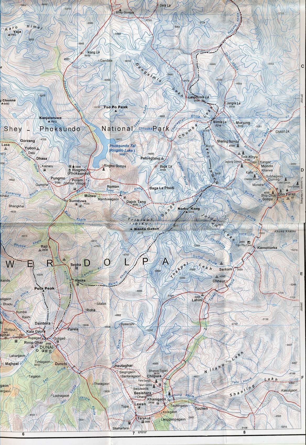
The best available map of Lower Dolpo has
many smaller errors, fortunately there are not many other
paths/routes in Dolpo. |
|
|
|
|
|
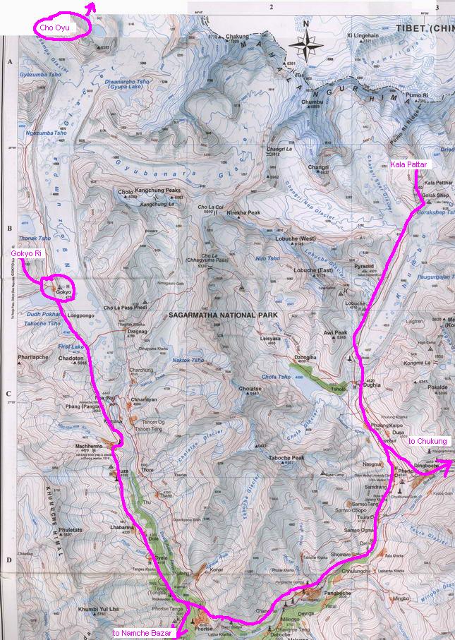
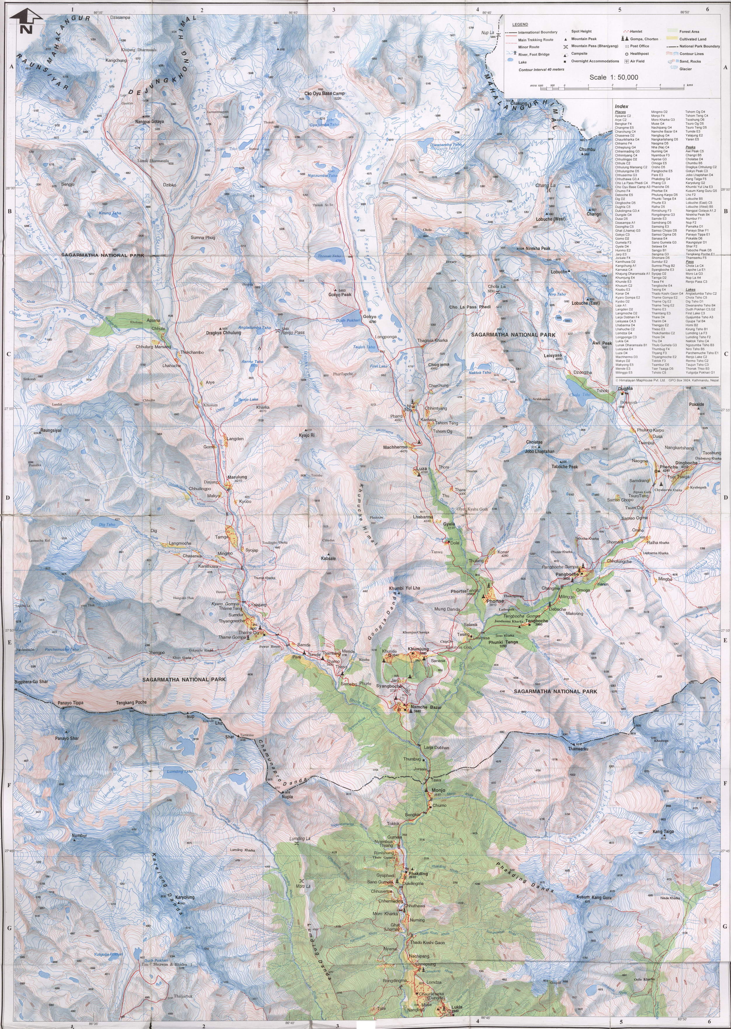
2 maps of Everest region |
|
|
|
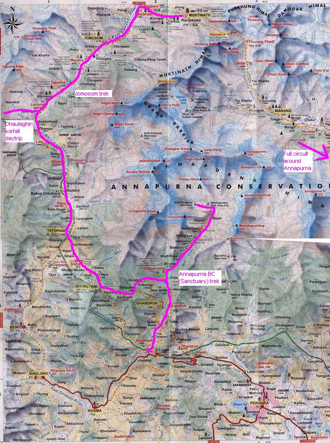
Annanapurna area - with my Jomosom part and Annapurna Sancturary part of the full Annapurna circuit marked. Better resolutioin here |
|
|
|
Illustrative map for all Makalu to Everest trek (alias 3col
trek as it crosses 3 high pases - East Col 6100m, West Col 6100m, Amphu
Labtsa 5800m). Our planned unsupported trek (as I part of longer stay
in Nepal) had to be cancelled unexpectedly before actually starting it
after most of our future group was evacuated from Honku Khola valley
(east under Merak Peak - there's no path there, although this
illustrative map shows it, but better maps do not show it). Detailed map of the 3 high passes area
can be
found here. |


|
|
|
|||||||
|
|
||||||||