 |
||||||||||
| Home | Photo | Gallery | Video | Info | ||||||
|
|
|||||||
|
|||||||
|
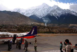
Jomosom airport with Anapurna massif in
background |
Good road now (end of 2006) stretched
from Jomosom north as far as Muktinath and south as far as Lete. In a
few years, motorcycles will be able to go all the way from Pokhara to
Muktinath. At that time, Jomosom trek will be best suited for mountain
bike riding, not trekking in my view. |
|
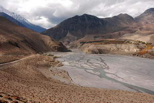
Between Jomosom and Kagbeni |
Nice old village of Jharkot (last village
below more more famous and not that nice Muktinath) |
|
Jharkot gompa |
Inside Jharkot gompa |
|
Inside Jharkot village |
Inside temple complex in Muktinath |
|
Inside temple complex in Muktinath |
View down from Muktinath with
Jharkot village on the hill in the middle |
|
View down from Muktinath with Jharkot village on the hill in the foreground |
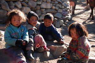
Children in Jharkot |
|
Children in Jharkot |
Preparing Tibetian tea in the long pipe
like pot |
|
Autumn in Jhakot village area with valley
leading towards Thorong La pass (right valley) |
Autumn in Jhakot village area |
|
Autumn in Jhakot village area |
Dry Mustang/Tibet like scenery in Jharkot
village area |
|
Dry Mustang/Tibet like scenery in Jharkot
village area |
Dry Mustang/Tibet like scenery in Jharkot
village area |
|
Near Kagbeni village (view towards
Jharkot/Muktinath) |
Kagbeni village, the valley right is
already in restricted Upper Mustang area |
|
Kagbeni village, the valley in distance is already in restricted Upper Mustang area |
View from Kagbeni into Upper Mustang |
|
View from Kagbeni into Upper Mustang |
Another view from Kagbeni |
|
People of Kagbeni |
People of Kagbeni |
|
Between Jomosom and Kagbeni |
Dhaulaghiri as seen from Larjung
village (half day down from Jomosom) |
|
|
||||||||
|
|
|
|||||||
|
|
||||||||


