 |
||||||||||
| Home | Photo | Gallery | Video | Info | ||||||
| |||||||
|
|||||||
|
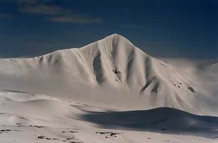
Upper part of BC is called "Onion Meadow" ("Lukovaya Polana" in Russian transcript") because wild onion grows there. This is the last place where it is possible to come by truck. The mountain, that can be seen on the photo, is about 5900m high "Peak of 19th Party Meeting" ("Pik 19 sjezda" in Russian transcript). |
The same place after "Asia Travel" company arrived and built big tents for their clients. First people came to "Lukovaya Polana" on 01.07. (we as well). It was still too much snow in this area. Better to come at least 1 week later. The best season seems to be from half of July till half of August. |
|
A picture with the normal route (the left one) and the Lipkin's route (the right one) on the peak Lenin. |
On the path from BC to "Traveler's pass" (or "Pereval Puteshestvenikov" in Russian transcript). The pass can be seen on the ridge in the mist. It is about 4100m high and about 3 hours from BC . |
|
After "Traveler's pass", the path descends to a glacier. A place of camp 1 is in the upper part of this glacier. |
A place about 3 hours below the camp 1 (about 4100 m, about 5 hours from BC), where we stayed before going to the real camp 1 (about 4300m). |
|
A place about 3 hours below the camp 1 |
A place about 3 hours below the camp 1 |
|
Some peak |
A View from the camp 1 down |
|
Camp 1 . Pik Razdelnaya can be seen on the right. The most common ascent route goes up the steep glacier (middle part of this picture) and a camp 2 would be a bit behind the edge (in 5300m). |
Peak Lenin from camp 1. Well, it is not very impressive mountain (in comparison with Khan Tengri e.g.). Because of lot of snow, we took a route over "Lipkin's rocks", where there is not such a danger of avalanches. |
|
To the camp 2 |
To the camp 2 |
|
A detail of the glacier on the normal
route
|
Camp 2 in about 5200m |
|
Camp 3 in about 6000m. Weather was good and when
the sun was shining it was possible to melt snow into water even in
this altitude - using a black sleeping mattress or digging about 20
cm under the snow where one could find liquid water (because
there are warmer rocks below the snow).
|
From the camp 2 to the top. |
|
Below the top . It is all just walking with trekking poles (and crampons of course), if the weather is good. |
A steep slope to the top. Some people use ice axes here for safety reasons (better to have them of course). |
|
A top photo of our group
|
A top photo (me and my father)
|
| ||||||||
|
|
|||||||
| ||||||||


